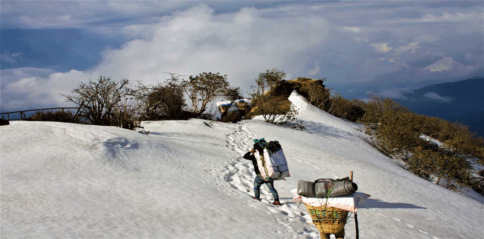

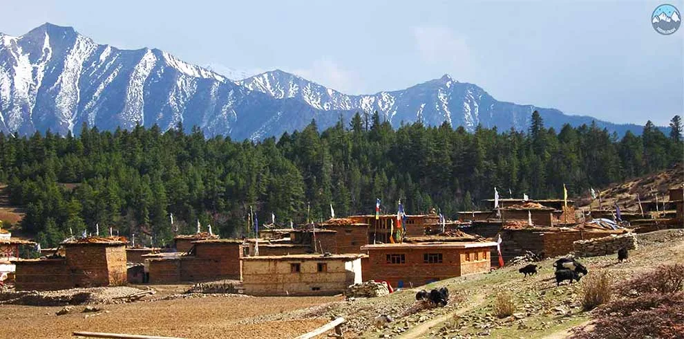
Upper dolpo Trek Nepal date availability
Itinerary
You will be picked up by our official Nepalgram crew and taken to your hotel from Tribhuvan International Airport.
From Dunai, we continue down Thuli Bheri until Suligad. From Suligad, we continue down Suligad River, which runs from Phoksundo Lake via a narrow, densely forested valley. The trail sways occasionally along to the raging white-water river and other times far above it. The path passes through a few small settlements, some of which are empty shacks made of stone, and we stop for lunch in Kageni. As we were on our trip, several of these towns were almost completely covered by an overgrowth of long grasses because they are mostly only inhabited in the winter when the residents of Upper Dolpo bring their livestock down from the high pastures.After lunch, we cross the Anke Khola, and as we go up the river to our campsite at Chepka, it can get rather hot (2850m).
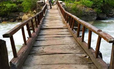
As we climb the small gorge, we cross the river numerous times as we ascend the undulating track through the bamboo and conifer forests of Shey Phoksundo National Park. In order to take us out of the woodland and onto flower-filled meadows, the track at one point climbs gradually for an hour or more. The route becomes easier as the valley gradually widens until we arrive at a bridge that leads to the village of Renje, where we halt for lunch. Renje is made up of a number of these houses. The trail continues as the valley narrows once more beyond this point.
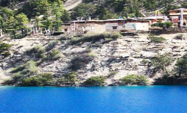
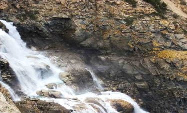
As we ascend from Samduwa, the Phoksundo Khola, a river that originates from the lake, flows freely. We move past Palam, another empty winter settlement, and ascend to a slope that divides Ringmo's wide fields from the small valley below. We catch our first glimpse of Phoksundo Lake as we look down at a thundering waterfall, one of the tallest in Nepal. We first make a steep descent through the forest before making a steady ascent to the lovely Dolpo-pa town of Ringmo, with its assortment of flat-roofed stone homes, stuccoed chortens, and long walls of prayer-carved mani stones. After passing past the town of Rigmo, we camp near Phoksundo Lake.
We begin our journey to Shey Gompa in Inner Dolpo with a breathtaking trail that circles the lake's westernmost point. The perilous path is carved out of the sheer rock cliffs, and at other parts it is supported by wooden trestles covered with boulders and saplings. The lake's crystal-clear turquoise waters are just below, therefore it is advisable to move forward while paying close attention to your step. This route was powerfully depicted in Eric Valli's outstanding film "Himalaya," which is about the Dolpo people who transport salt from Tibet on their yaks across treacherous passes to sell for essential grain in the south.After completing this strenuous journey, the trail ascends to a crest that offers breathtaking views of Ringmo's lake, lush forest, and vibrant fields, as well as the snow-capped peak of Kang Norbu to the south. At a little over 4000 meters, a cairn and prayer flags mark our ridge's highest point. From there, we gradually descend to the lake's northern bank, where we have lunch.
The trek from Phoksundo Lake to the North Bank, which is located at an altitude of 3700m, typically takes 4-5 hours.
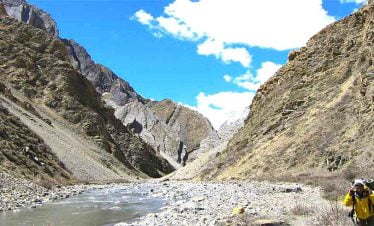
We follow the plain river bank and pine woodland at the foothills of Mount Kanjiruwa from the north bank. The Phoksumdo Valley soon after narrows considerably, with tall rock cliffs on both sides. We must ford a number of tributaries, some of which may require wading. We exit the main valley after about 20 or 30 minutes and turn back toward the north, entering a little gorge. We have a long ascent, frequently without any sign of a track as we ascend the valley's steep sides, passing sporadic grazing fields and fording multiple minor streams. We set up camp at the location that Peter Mathiesson referred to in his book as "Snowfields Camp" because we are following in his footsteps.
We have a day to explore the area and finish off camp duties like laundry. The spectacular Kagyupa monastery of Tsa Kang, which is perched on a precarious ledge high up a cliff face, is the destination of our side trip in the afternoon. To get there, we must partially ascend the path that pilgrims use to complete the Crystal Mountain's "Kora," or circuit. We eventually return to Shey Gompa.
Cost Details of Upper dolpo Trek Nepal
| S.No. | Luxury | All Incl | Service | |
| 1 | Cost (in USD $) Details | |||
| 2 | Licensed Guide | √ | √ | √ |
| 3 | Accommodation during trek | Standard | Private | × |
| 4 | Transportation to trek start point | Private | Shared | Shared |
| 5 | Shower | √ | √ | √ |
| 6 | Airport/bus terminal Shuttle service | Private | Private | × |
| 7 | Hotel at KTM | 5 Star | × | × |
| 8 | Food on trek (BLD) | Unlimited Meal | 3 Meal | × |
| 9 | Desert | From Menu | Fresh Fruit | × |
| 10 | Soft drink | unlimited | 1 | × |
| 11 | Porter | Private | Shared | × |
| 12 | Company Cap & T-shirt | √ | √ | × |
| 13 | Dawn Jacket & Sleeping – bag to be returned | √ | √ | × |
| 14 | Hard drink | Local Brand | × | × |
| 15 | Warm up hike | √ | × | × |
| 16 | Farewell party/dinner | √ | × | × |
| 17 | Buffer day for trek | √ | × | × |
| 18 | Food in the city | × | × | × |
General Information About Upper Dolpo Trek Nepal
One of the world’s longest and highest walking pathways, the Upper Dolpo Mugu Trek is made up of a network of already-existing treks and trails. A projected path that would go from Namche Barwa in Tibet to Nanga Parbat in Jammu and Kashmir would span up to 6200 km of the Greater Himalaya range. As a result, one passes through Tibet, Nepal, Bhutan, India, and Kashmir. It is the world’s highest and longest alpine walking track. Evidently, only Nepal and Bhutan are listed as having been traversed on foot.
Tourists are drawn in large numbers by the Upper Dolpo Mugu Trek, but the most well-liked locations have only been in the Solukhumbu, Everest, Annapurna, and Langtang regions. A trekking path that includes both well-known locations and other, less well-known destinations is made possible by the Great Himalayan Trail (relatively poor but with enormous tourism potential). The Trail also connects a variety of the less popular tourist attractions and goods in Nepal’s mountainous region with the goal of creating an iconic travel experience for tourists from all over the world.
Accommodation in Upper dolpo trek
The Upper Dolpo trek is a remote and challenging trek in western Nepal, and accommodation options are limited along the trail. Here are some accommodation options you may consider while trekking in Upper Dolpo:
Tea Houses: Throughout the Upper Dolpo trek, there are a few tea houses (local lodges), however they are fairly basic and might not match the expectations of many trekkers. These tea houses typically provide a basic room with a communal dining area and restroom.
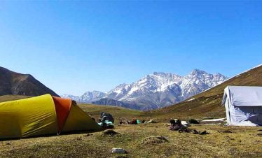
Camping : The most popular type of trekking in Upper Dolpo is camping. You can rent camping equipment in Pokhara or Kathmandu or bring your own. You can pitch your tent at authorized camping areas or ask nearby villages for permission to stay on their property.
Homestays: In Upper Dolpo, homestays are gaining popularity, and certain communities provide homestay accommodations. This is a fantastic approach to get a feel for the culture and way of life there.
Best season for Upper dolpo trek
The best season for the Upper Dolpo trek is from mid-April to mid-June and from mid-September to mid-November. These months are generally considered the peak trekking season in Nepal because the weather is clear and dry, and the temperature is mild.
The weather is favorable and the hills and forests are in full bloom from April to June, making for a lovely trekking experience. The monsoon season, which lasts from July through August, brings significant rain to the area, making trekking demanding and difficult.
The ideal time to go trekking in Upper Dolpo is in the fall, from September to November. Cool and dry conditions prevail, and the clear skies offer breathtaking views of the mountains in the area. The harvest season also falls at this time, and you may see how the villagers celebrate their customary holidays.
The Upper Dolpo region is covered in snow from December through March, and temperatures can plunge below zero. Trekking during this time of year is not advised as the trails can be impassable owing to snow and ice.
Difficulty level of Upper Dolpo Trek
The difficulty of a hike in the Himalayas might increase due to a number of circumstances. The Upper Dolpo journey is challenging in large part due to its lengthy schedule, which includes multiple days of , steep ascents and descents in terrain that resembles a desert.
This hike is not for the faint of heart because there are two 5,000-meter mountains to climb and numerous days spent above 4,000 meters. The highest point on this hike is Kang-La Pass, which is located at 5,151 meters. Moreover, elevations above 3,500 meters are thought to be where the danger of altitude sickness starts. Acclimatization is essential for this climb as a result. You must alert the guide or the trek leader as soon as you experience any of the symptoms, as they have received extensive first aid training and have Himalayan experience. These symptoms include unease, breathing difficulties, headaches, increased heart rates, nausea and vomiting, difficulty sleeping, etc.Yet, you may prevent serious altitude troubles by staying hydrated, taking it slow, and paying attention to your body.
It’s important to note that Upper Dolpo is the least developed part of the nation. Not only the altitude but also isolation and a dearth of basic services are drawbacks.
Before traveling to Upper Dolpo, hikers should research the general climate of the area throughout the several seasons. The locals or the knowledgeable must be able to advise you on the ideal time to visit the area.
While some experience with high-altitude excursions is helpful, anyone can go hiking without any specific skills or climbing gear. But, you must possess a high degree of walking endurance in addition to being in top physical and mental health. As a result, we suggest that you engage in some cardio-vascular activities, hiking excursions, and physical sports well in advance of the trip’s departure.
Trekking to Upper Dolpo is therefore challenging in the truest sense but extremely rewarding.
Highlights
- Spectacular flight from Kathmandu, the country's capital, to Juphal
- A beautiful stroll through the home country of some of the tallest mountains in the world
- Take in the landscape and spectacular sights.
- Learn about the distinctive way of life and culture of the mountain people.
- Visit the magnificent monasteries that have been constructed over many years.
- Variety in Biodiversity
- Tibetan Buddhism and Bon are still practiced today.
Cost Includes of Upper dolpo Trek Nepal
- Breakfast, Lunch and Dinner during the trek and fresh fruit every night after dinner.
- All accommodation during the trek.
- All necessary paperwork, entry permits & entrance fee.
- English speaking and trained, Government licensed guide including all his salary, food, drinks, accommodation, transport and insurance during the trek.
- A helpful porter with proper equipment (one porter for two people).
- Medical supplies (first aid kit) with regular oxygen saturation check up.
- All government taxes and office expenses.
- Added Value - (1) Dawn sleeping bag, Dawn Jacket to be returned after the trek (2) Waterproof duffel Bag, Walking Poles, quick dry T-shirt, Cap - to take away (3) Oxymeter to check your oxygen saturation and Heart beat with medical kit box carried by Guide (4) Satellite Phone for extremely remote destination.
Cost Excludes of Upper dolpo Trek Nepal
- International airfare.
- Nepal entry visa fee (you may easily issue the visa upon your arrival at International Airport – Kathmandu). You need 30$ dollar visa fee for 15 days, cash money will be easier.
- Tips/Gratitude (expected but not compulsory)
- Your Travel and medical insurance for emergency, we assist you with the arrangement
- All alcoholic and non-alcoholic hot and cold drinks, except tea/coffee with breakfast.
Given the terrain and elevation, the Upper Dolpo Trek is regarded as one of the most difficult treks in Nepal. The walk is remote and traverses over some of the Himalayas’ highest passes, with heights as high as 5,350 meters (17,550 feet).
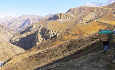
The trek also entails many days of walking, frequently on challenging terrain, and calls for a high level of physical preparedness and endurance. It can be difficult to navigate the path because it crosses tough terrain, high-altitude deserts, steep gorges, and pure alpine woods.
Also, the infrastructure and amenities available along the route are limited due to the trek’s remote location. Trekkers must therefore be self-sufficient and ready to spend many nights camping in challenging conditions.
The Upper Dolpo Trek is a high altitude trek in Nepal that reaches elevations of up to 5,350 meters (17,550 feet) at the top of the high passes. The trek starts from Juphal, a small airstrip in the Dolpo region of western Nepal, and takes trekkers through the remote and pristine landscapes of the Dolpo region. Along the way, trekkers will cross several high passes, including the Numa La Pass (5,190 meters/17,023 feet) and the Baga La Pass (5,070 meters/16,630 feet), before reaching the highest point of the trek at Shey Gompa (4,126 meters/13,537 feet).
The distance between Kathmandu and the starting point of the Upper Dolpo Trek, which is the town of Juphal, is approximately 445 kilometers (277 miles) by road. However, since there are no direct roads from Kathmandu to Juphal, the trekking route typically involves flying from Kathmandu to Nepalgunj, a town in the southern plains of Nepal, and then taking a connecting flight to Juphal. The flight from Kathmandu to Nepalgunj takes about an hour, and the flight from Nepalgunj to Juphal takes about 45 minutes. The trek itself is around 170 kilometers (105 miles) and can take anywhere from 24-27 days to complete, depending on the pace of the trekker and the itinerary chosen.
The Upper Dolpo Trek takes place in the Dolpo region of Nepal, which is located in the far west of the country. The trek starts from the town of Juphal, which is situated in the Dolpa district, and takes trekkers through some of the most remote and pristine landscapes in Nepal.
During the trek, you will pass through several traditional villages, including Dunai, Tarakot, and Saldang, where you can experience the unique culture and lifestyle of the Dolpo people. The route also takes you through beautiful alpine forests, arid deserts, deep gorges, and high altitude passes, such as the Numa La Pass and the Baga La Pass.
The highlight of the trek is the visit to the Shey Phoksundo National Park, which is home to the stunning Phoksundo Lake, one of the deepest lakes in Nepal. The trek ends at Jomsom, a popular town in the Mustang district, from where you can take a flight back to Pokhara or continue on to other destinations in Nepal.
The temperature during the Upper Dolpo Trek can vary greatly depending on the season and the altitude of the trekking route.
In general, the best time to do the Upper Dolpo Trek is during the spring (March to May) and autumn (September to November) seasons, when the weather is dry, and the skies are clear. During these seasons, the daytime temperatures at lower altitudes can range from 15-25°C (59-77°F), while at higher altitudes, the temperatures can range from 0-15°C (32-59°F).
During the winter months (December to February), the temperatures in the Dolpo region can drop to well below freezing, and the higher elevations can experience heavy snowfall, making the trek difficult or even impossible. In the summer months (June to August), the region experiences the monsoon season, with frequent rain showers and cloudy skies, which can make the trek more challenging and muddy.
Overall, it is important to be prepared for a wide range of temperatures during the Upper Dolpo Trek and to bring appropriate clothing and gear for the conditions.
More Information About Upper Dolpo Trek Nepal
Upper dolpo trek Nepal is One of the most thrilling and hard treks in Nepal, Nepal takes travelers through a remote region of northwestern Nepal. This most difficult trip begins in Dolpo and travels through Upper Dolpo and Upper Mugu to reach Mugu. The path passes by the breathtaking Kanjiruwa massif and peaks along the northern boundary.

This excursion, which spans several 5000-meter passes, is very adventurous. It offers cultural immersion in addition to mountain splendour and natural immersion.
Another benefit of this walk is getting to experience the cultures of the Mugum and Dolpo ethnic groups, as well as the old monasteries and isolated settlements.
For explorers, this Upper dolpo trek Nepal is the best trekking route. The path passes by historic monasteries, secluded villages, and crystal-clear alpine lakes as it winds through the breathtaking Dolpo mountain environment.
We journey via several mountain passes that are about 5000 meters high on an incredibly uncommon path. Although there are no glacier inspections on this Upper dolpo trek Nepal, it is nevertheless a major task because of the tremendous privacy and occasionally challenging terrain.
Few trekkers have signed up for this trip so far, and Himalaya Tours is likely the only Western travel company offering this amazing trip.
Best route for Upper dolpo trek Nepal
The best route for Upper dolpo trek Nepal we can Start your Dolpo Mugu hike from Juphal and proceed past Phoksundo Lake in search of the famed Crystal Monastery Shey.
In Bhijer, we divert from the main road and travel over remote roads that wind through Mugu’s deep gorges and over high passes. The few villages in this area are regarded as being the farthest away.
Our hike takes us to the Rara Lake National Park, which is home to Nepal’s largest lake. The Dolpo to Rara traverse trip links two of Nepal’s most stunning high altitude lakes. Dolpo’s desolate yet breathtakingly gorgeous scenery serves as the starting point, and Mugu’s similarly stunning area serves as the destination.
The three-week Dolpo Mugu walk passes through the isolated, scenic settlements of Dolpo and Mugu. Six high passes are encountered along the trail’s high, steep, narrow, and rocky well-traveled paths. From Juphal, we travel by Phoksundo Waterfalls, a breathtaking waterfall, and Phoksundo Lake.
Shey Gompa can be reached by traversing Phoksundo Lake and the infamous Kang La pass, which is located at a height of 5360 meters. Our travel from Shey Gomp to Bhijer and Pho continues via Samling Monastery. After Pho Village, we spend a week in the wilderness and go across three difficult mountains to reach Shailenchaur Kharka: Nyimagyalzen La (5567m), Yala Pass (5414m), and Chyargo La (5150m).
This is allegedly a historic smugglers’ trail and one of the Great Himalaya Trail’s variations; it is rarely used by hikers. The walk ends at Rara Lake/Talcha after a detour to Mugu Village from Shilenchaur via the Mugu Karnali River.
Outline Itinerary for Upper dolpo trek
Day 1: Arrival in Kathmandu and transfer to Hotel
Day 2: Kathmandu to Nepalgunj flight 1 hour (Afternoon)
Day 3: Dunai to Chhepka(2850m) 6 hours
Day 4: Chhepka to Sumduwa(3885m) 5-6 hours
Day 5: Sumduwa to Phoksumdo Lake (3600m) 4-5 hours
Day 6: Acclimatization/rest day at Phoksumdo Lake.
Day 7: Phoksundo Lake to North Bank(3700m) 4-5 hours
Day 8: North Bank to Kangla Basecamp (4600m) 5-6 hours
Day 9: Kangla Basecamp to Shey Gumba (4370m) 6-7 hours via Kang La pass (5350m)
Day 10: Rest day at Shey Gompa
Day 11: Shey Gompa to Tora/ Samling Gompa (4120) 6-7 hours
Day 12: Tora/ Samling Gompa to Bhijer (3850m) 3 hours
Day 13: Bhijer to Tora Khola (3400m) Crossing Yambur La (4800m) 6-7 hours
Day 14: Tora Khola to Pho (4020m) 3-4 hours
Day 15: Pho to Daldung Khor(4700m) cross Nyingma Gyalzen La (5563m) 8-9 hours
Day 16: Daldung Khor to Swaksa Khola/Pung Kharka (4500m) 3-4 hours
Day 17: Pung Kharka to Marjung Khola or the Chyandi Khola (4800m) crossing Cross the Yala La (5414m) 7-8 hours.
Day 18: Chyandi Khola to Takla Khola (3750m) 7-8 hours
Day 19: Takla Khola to Thajuchaur (4000m) Crossing the Chyargo La (5100m) 7-8 hours
Day 20: Thajuchaur to Shilenchaur Kharka (2945m) 5-6 hours
Day 21: Sparse Day- It can be used in-case of difficulty or Detour to Mugu village
Day 22: Shilenchaur KharkaTrek to Pulu or Riusa (2250m) 7-8 hours.
Day 23: Pulu to Kumpha (2010m) 7-8 hours.
Day 24: Kumpha to Talcha Airport (2750m) 7 hours.
Day 25: Fly from Talcha to Nepalgunj and Kathmandu.
Day 26: Free day in Kathmandu which can also be used as contingency.
Day 27: Departure day
This trip is 100% customizable
 Big Group? We can help safer
Special request? We fit
Different Itinerary? We moderate
QUICK INQUIRY
KNOW BEFORE BOOKING
TRIP Deposit is 92% refundable & 100% Transferable
Middleman free & Transparent
READ the DEFINITION OF Trip Difficulty
USE Multiple Payment Options